


-
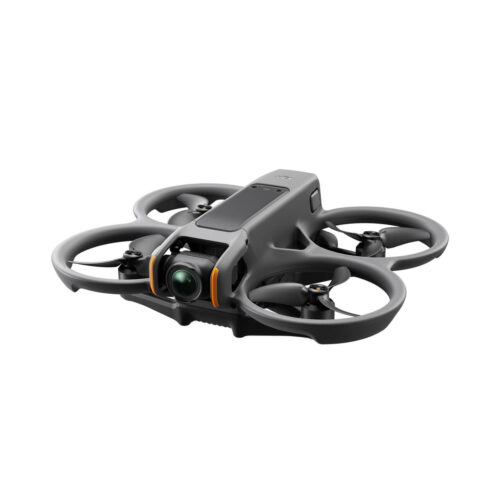
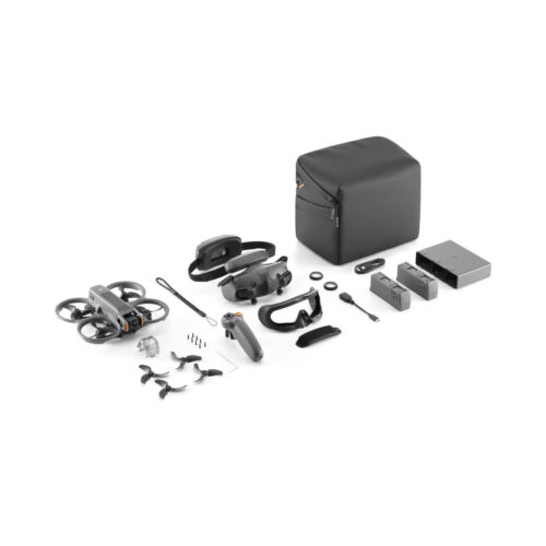
DJI Avata 2 is an FPV drone designed to support indoor law enforcement operations by providing real-time aerial intelligence in confined environments. Paired with DJI Goggles 2 and flexible control options, it helps officers assess threats, clear structures, and improve safety before entry.
-
Out of stockImmersive Flight Experience | Intuitive Motion Control | Easy ACRO | Tight Shots in Super-Wide 4K | Built-In Propeller Guard | Hassle-Free POV Content
-
The DJI Matrice 4 Enterprise offers advanced AI, enhanced sensing, and a laser range finder for safer enterprise operations. The 4E targets surveying and construction industries. Upgraded accessories boost their capabilities for intelligent aerial tasks.
-
See below for our list of remaining drones, accessories, and parts. All items are 20%-70% off Please call (303) 502-2555 for pricing
-
The DJI Matrice T Thermal offers advanced AI, enhanced sensing, and a laser range finder for safer enterprise operations. The M4T targets the inspection and public safety industries. Upgraded accessories boost their capabilities for intelligent aerial tasks.
-
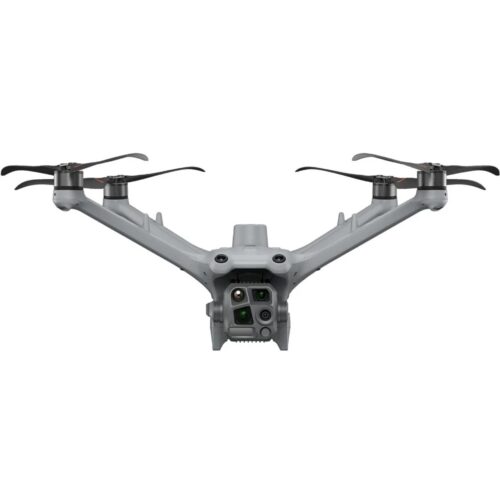
The DJI Matrice 4 Series is a compact, intelligent enterprise drone lineup featuring the Matrice 4T and Matrice 4E. With advanced AI, enhanced sensing, and a laser range finder, it delivers safer, more reliable operations. The 4T supports public safety, emergency response, and utilities, while the 4E is optimized for surveying, construction, and mining, supported by upgraded accessories for advanced aerial operations.
-
The As1 advanced speaker system delivers an impressive volume of 114 decibels at a distance of 3.28 feet (1-meter), ensuring your message is heard clearly over a broadcast range of up to 984 feet (300 meters). Designed for versatility, AS1 supports recorded messages, media imports, and text-to-speech conversion, making it suitable for a variety of communication needs.
-
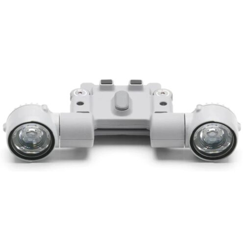
This high-performance spotlight expands your drone’s operational range with adaptable lighting and seamless system integration. Equipped with both continuous and strobe modes, the DJI AL1 Spotlight delivers strong, reliable illumination on targets from as far as 100 meters away. It’s a practical solution for a wide range of missions, including search and rescue, low-light operations, and nighttime inspection work.
-
The all-new water and dust-resistant DJI Matrice 4D and 4TD can be paired with the DJI RC Plus 2 controller for Enterprise use or integrated with the DJI Dock 3. Both drones are equipped with a wide-angle camera, a medium tele camera, a tele camera and a Laser Range Finder. Matrice 4D is highly effective for professional high-precision mapping and detailed surface inspections. Matrice 4TD is equipped with an infrared thermal camera and a new NIR auxiliary light, making it suitable for a wide range of applications such as utility inspections, emergency response, and public safety.
-
The DJI Matrice 4D delivers fast, accurate photogrammetry for land surveying, mapping, and construction projects. With precise positioning, long endurance, and an IP-rated weather-resistant design, it reliably captures detailed imagery for high-quality 2D and 3D site models. Ideal for topographic mapping, progress tracking, and measurement workflows, the M4D streamlines field operations while delivering dependable, survey-grade results.
-
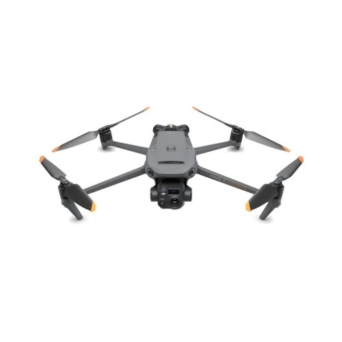
Capture critical data with the DJI Mavic 3 Enterprise and Mavic 3 Thermal Advanced, built for inspections, mapping, and public safety missions. These drones combine high-resolution visual and thermal imaging, intelligent obstacle sensing, and long flight times for fast, reliable, mission-ready results.
-
This compact enterprise drone delivers survey-grade accuracy and efficient aerial data capture for land surveying, construction, and mapping professionals. With a mechanical shutter, RTK support, and long flight endurance, it enables fast deployment and reliable results across demanding job sites.
-
This compact enterprise thermal drone delivers fast, reliable aerial inspections for utilities, solar and wind energy, and public safety operations. With advanced thermal imaging and rapid deployment, it provides critical situational awareness while improving safety and response efficiency.
-
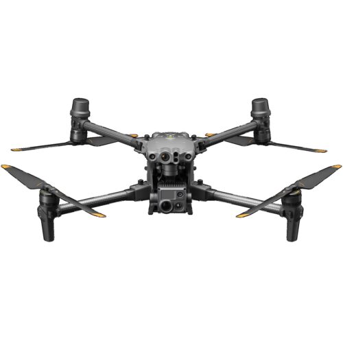
The DJI Matrice 30 Series includes the M30T for public safety and industrial inspections with thermal and visual imaging, and the M30 for surveying and construction, delivering high-resolution visual data, AI-assisted flight, and IP55 weather resistance for reliable performance in challenging environments.
Call Us Today! (303) 502-2555 | Hours: Mon – Fri 8am to 5pm


2130 S. Bellaire St
Denver, CO 80222
Phone: 303-502-2555
Email: info@djicolorado.com
Hours of Operation
M-F 8:00AM-5:00PM
Featured Products
-
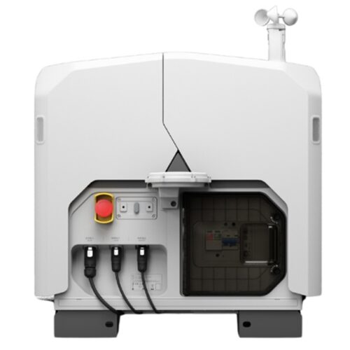 DJI Dock
-
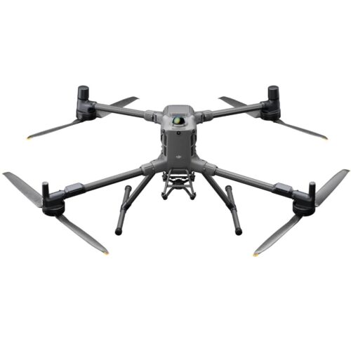
 Matrice 4 Series
-
 Matrice 400
$15,000.00
Matrice 400
$15,000.00
Explore
© Copyright 2012 - 2026 | DJI Colorado | All Rights Reserved